#GC2022 is accepting submissions - 25d 27h 05m 44s

Moravia, Medellin, Colombia
PREMISE
The United Nations estimates suggest that today nearly one billion people live in "slums" worldwide. In reference to Mexico City, architect Jose Castillo points out that the increase of informal settlements has become "the norm rather than the exception," and has therefore eroded our notion of what the city is. The discourse of the global city can no longer exclude and is no longer separate from the informal one.
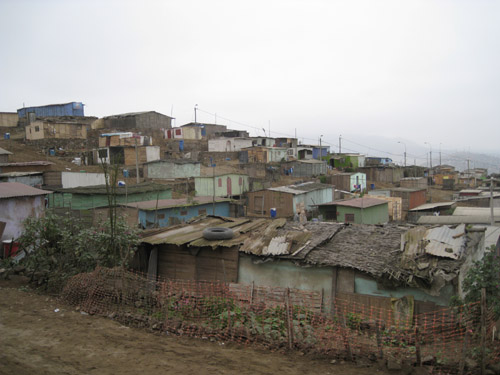
Ventanilla, Lima, Peru
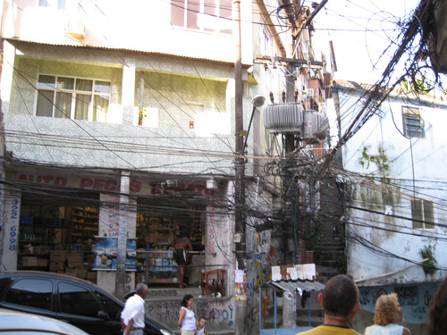
Rocinha, Rio de Janeiro, Brazil
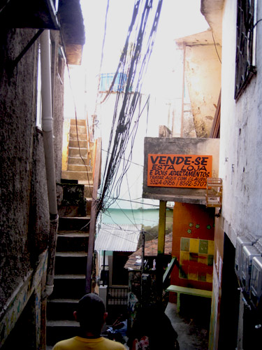
Rocinha, Rio de Janeiro, Brazil
With a large percentage of the urbanization in the world today happening informally, how should we manage urban growth? How should we balance the growing urban population, the rights for shelter and rights to the city, with the aims of environmental management and a more inclusive and equitable urbanism and development? Responding to the current increase in urbanization, fragmentation and the resulting marginalization of spaces and people, architecture can no longer simply concern the materiality of inhabited space (urbs) but needs to recognize that the acts of building and claiming space are politically charged acts that define the political status and the right to the city of its inhabitants (civitas). Thus, a redefinition, reevaluation, and reconfiguration of strategies of intervention in the city are essential.
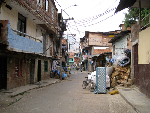
Moravia, Medellin, Colombia
FAVELA CHIC
Although architects and planners have addressed informal settlements, or favelas, for over sixty years, it is only recently that there has been a shift in the paradigm. Following a long history of tabula rasa, public housing, self-help, and sites-and-services schemes, current approaches to the favela have evolved into strategies characterized as urban acupuncture, aiming to minimize displacement and improve the conditions in the area by focusing on the aspects most absent in the settlement: infrastructure, public space, and public equipment. We are now witnessing spectacular libraries in depressed neighborhoods, gondola systems in marginalized areas, and museums in informal settlements. It seems as though we have returned to the notion slums of hope, no longer vilifying informal settlements, but viewing them as integral in the development of the city, thereby reformulating the discourse of the growing city and the relations between global and informal. With design as a central component in the approach and through interventions that acknowledge and legitimize urban informality, the favela has returned to the center of the urban discourse and practice, hinting towards a new paradigm; a paradigm that I am calling Favela Chic.
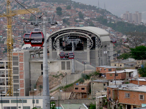
Metrocable in San Agustín, Caracas, Venezuela
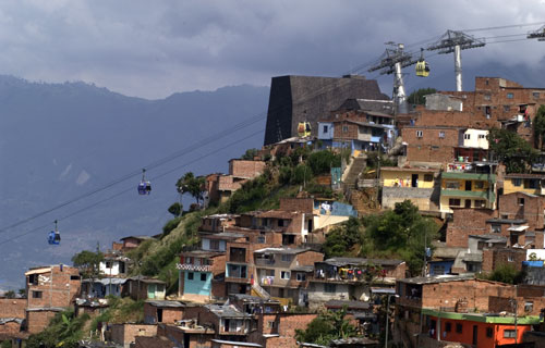
Metrocable and Library of Spain in Santo Domingo, Medellin, Colombia, image source: Miles Knowles

Centro Educatico Unificado (CEU), Heliopolis, Sao Paulo, Brazil
Currently, the most interesting efforts to address favelas are exemplified in Latin America, where the growing economies coupled with decentralization and democratization processes have resulted in stronger local autonomy and participation in urban development projects, as well as a new emphasis to reflect citizen rights through city form.
As such, the case of Guayaquil, Ecuador, is an interesting one. Guayaquil's upgrading strategy was established through a public-private partnership-Fundación Malecón 2000- and now boasts a portfolio of urban renewal projects that have brought international attention. Amongst the most notable of these projects is the case of Malecón del Salado, a waterfront renovation project on a large salt marsh near the city's downtown.
GUAYAQUIL [ECUADOR] ::: Regeneración Urbana
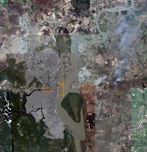
Guayaquil Location
City Population: 2,600,000
[Metropolitan Area: 3.3 million]
Density 19,547.40/sq mi
Population in Informal Settlement: ~600 000
Location: The city is located between the Guayas River and the Salado Estuary.
Land Area: 122.17 sq mi
Guayaquil is Ecuador's largest city, chief port, and principal commercial and manufacturing center. The city has around 3,000,000 inhabitants, from which 600,000 live in informal cities. Since Ecuador's independence in 1830, Guayaquil has been the country's first port and trading hub. With a physical landscape of marshes and tropical attributes, the city's urban configuration formed around the production of cacao in the eighteenth century.
Transformations in the urban development and redevelopment of Guayaquil accelerated since the middle of the twentieth century, evolving from reconstruction, to revitalization, renovation and now regeneration, each having particular meaning and emphasizing particular strategies. Most prominent, in 1996, León Febres Cordero's administration created the Plan Integral, or master plan, for green spaces and urban parks. The plan led to the first restoration projects in urban areas where banks (or private entities) could adopt a park for maintenance.
In 1997, still under the administration of Febres-Cordero, the Malecón 2000 marked the initiation of urban reform and beautification scheme for the city. Labeled as Regeneración Urbana or "Urban Regeneration," the main goals were to attract more foreign investment and gear the city towards a tourism economy. Through the initial public-private partnership -Fundación Malecón 2000- the city's urban regeneration began with the Malecón 2000, the city center's waterfront renovation and beautification project. With the addition of new public organization - the Fundación Guayaquil Siglo XXI- serving as administrator to urban regeneration projects, Guayaquil now boasts a large repertoire of upgrading interventions in marginalized and informal settlements (or asentamientos informales). Some of the most noticeable projects include the urban promenade and façade painting of Las Peñas neighborhood at the foot of the Santa Ana Hill, an urban beach La Playita, and a second waterfront renovation project, Malecón del Salado.
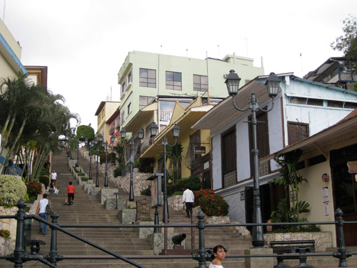
Las Peñas promenade
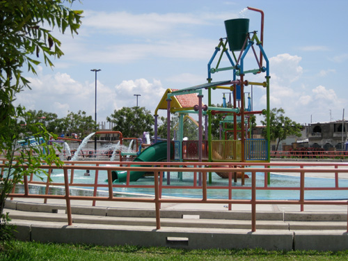
Viernes Santo Water Park
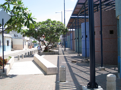
Guayaquil, Ecuador
MALECÓN DEL SALADO
Architects: Fundación Malecón 2000
Constructed Area: 609 614.07 sq ft
Cost: ~ $ 20 000 000 (us dollars)
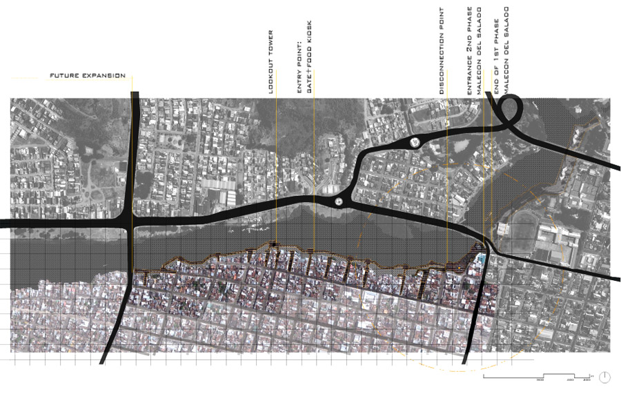
Malecón Salado Site Diagram
The waterfront renovation, Malecón del Salado, was built in two distinct phases. The first phase, located in a 'formal' area, joins the public university Universidad Central, the public library, a junior school, and Guayaquil's Tennis Club. The intervention includes a waterfront promenade, a bridge/street overpass, food kiosks, bars and, clubs.
A four-lane street marks the end of the first phase project and the beginning of the second phase. The second phase project is located in an area that, until recently, was considered to be an informal settlement. The settlement was established in the 1960s with stilt houses made out of cane and bamboo. Slowly the area evolved, consolidating its housing stock and land fills, and is now primarily made up of concrete structures. Today, after the urban regeneration took place, most of the housing in the area has been legalized, and basic services formalized.
This second part of the Malecón is 17 blocks long; close to 3 km, with a planned future expansion that would make the waterfront renovation close to 6 km long. In this particular section of the project, the Malecón is not a land promenade but a floating boardwalk, running parallel yet separate from the edge of the land.
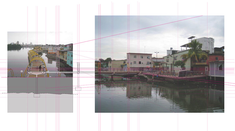 Sectional diagram, waterfront promenade
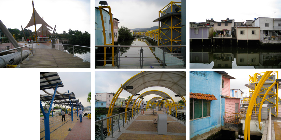
Waterfront promenade, views and progression
Although there are specific extensions (following existing street patterns) that link back to the land where small colorful public plazas and squares were created, these are heavily guarded by 4 to 5 meter gates (open from 6AM to 11PM) and armed guards, marking a clear disconnect between land and water, between internal conditions and that tourist landscape painted for the Malecón. All entry points to the boardwalk are flanked by bright food kiosks and large mechanical boxes. There are a total of 17 kiosks – selling food and drinks- which are leased by residents of the area (required a permit from the municipality).
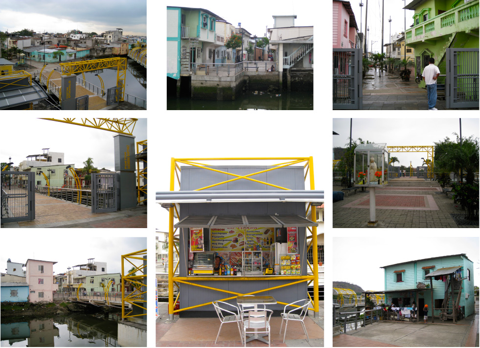
Entry points, food kiosks, public spaces
From my understanding, there was little displacement in the area, and existing residents were allowed to remain in their houses. Aside from the long floating boardwalk, the project included the construction of public spaces, paving of street, alleyways and the formalization of services. All existing commercial businesses were required a permit and city signage, while surrounding facades were painted bright colors seeming to convert the area into a masked vernacular settlement – although the interiors of houses were left in the same deplorable and unsafe states. Except for the area adjacent to the waterfront, the rest of the settlement was left untouched.
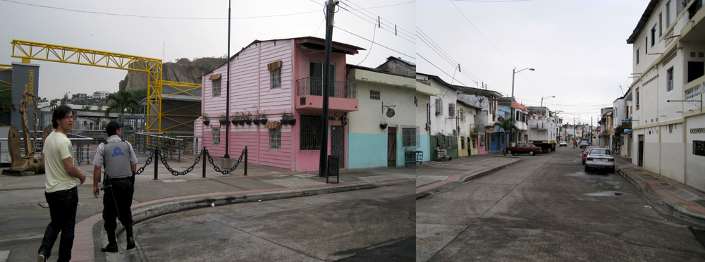
Caption: Street renovations near the waterfront
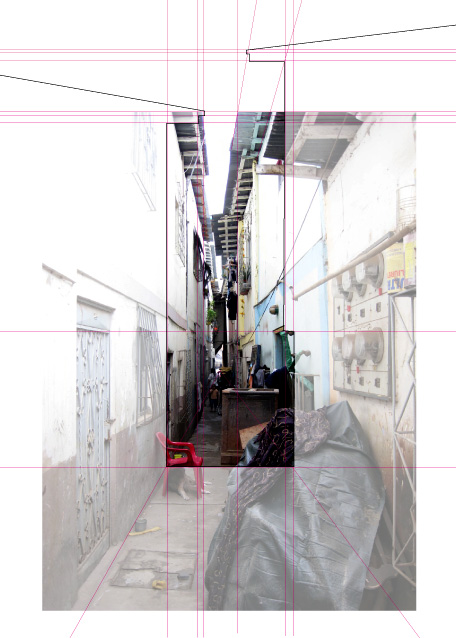
As general measures, alleyways are close to 1m in width and are close to 8 houses deep, giving access to approximately 16 houses total.
During my visits to the project, I frequented Marta, a 50 year-old woman who makes her living from a small corner store- a space she was able to carve out of her living room. Her home is located on one of the main streets running parallel to the waterfront. "Before the regeneration," Marta stated, things were going better. In her point of view, the Malecón has actually made her business decrease, as passers by take the boardwalk, bypassing interior streets. Also, since the formalization, Marta can no longer take out her grill, 2 plastic tables and chairs –which she called her main selling points: good barbecue and a place to sit. The payment for the required permits, the formalization of services, the decrease in clientele and the many restrictions on the use of space has made it difficult for Marta and her family to get by.
In addition, from the 17 kiosks on the boardwalk, it turns out that only 8 or 9 operate regularly (these are located towards the "formal" section of the Malecón). The rest only open during the city's festivals (in the summer time); the reason, I was told by residents of the area, is the decrease of business and tourism due to the increase in policing and restrictions.
Although this Malecón del Salado is a striking project, the closer one looks, the clearer one begins to see the altered aesthetics masking the conditions of informality, the struggle of residents, attempting to cater to the tourist experience of a promenade along a colorful, vernacular settlement.
**All images and graphics were created by the author unless otherwise noted
NOTE FROM AUTHOR ::: Adriana Navarro-Sertich [FAVELissues]
Adriana holds a dual Master’s of Architecture, and City and Regional Planning form the University of California, Berkeley. In 2010, Adriana had the privilege of conducting an entire year of empirical work, through the John K. Branner Fellowship, one of the largest travel fellowships awarded to Masters students in the United States. Through her field studies, focusing on more than 10 countries in Latin America [primarily Ecuador, Colombia, Venezuela and Brazil] and also including South Africa, Egypt and China, Adriana developed a comparative analysis of current Favela Chic interventions, discussing the different typologies and strategies, as well as the potentials and limitations of current practices in ‘slum upgrading.’ Many of her travels and observations were recorded through her blog: www.FAVELissues.com, which today has transformed into an interdisciplinary platform featuring emergent and prominent practitioners and researchers in the field of urban informality. Adriana is currently working on her thesis publication.